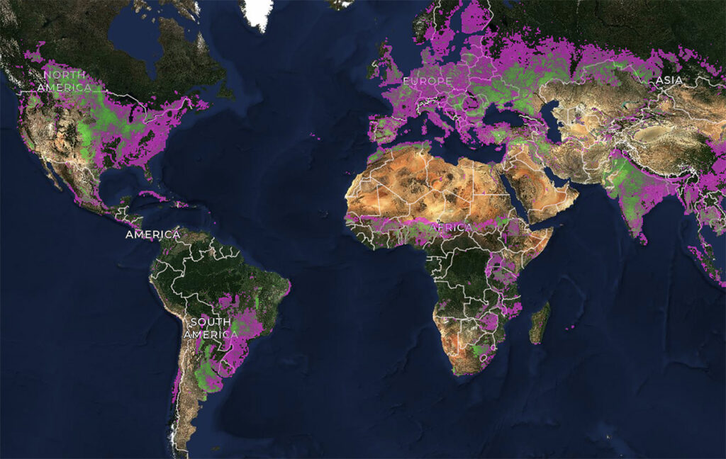
Nearly half of the world’s habitable land is used for agriculture, according to the World Economic Forum. Now, for the first time, every agricultural field on Earth has a boundary on a map, thanks to a novel model designed to infer field boundaries all over the world.
Nathan Jacobs, a professor of computer science at WashU McKelvey Engineering and co-director of the WashU Geospatial Research Initiative, was part of a collaboration of academic and industry researchers who developed the model, which was funded and co-developed by Taylor Geospatial and the Microsoft AI for Good Lab. Their goal was to make geospatial artificial intelligence (GeoAI) publicly available worldwide.
Agricultural field boundary maps that define individual farm plots are important to monitor agriculture and help in making decisions, as well as mapping types of crops, estimating yields, surveilling for pests and diseases and tracking programs. Having updated maps would be a boon to agriculture and to food security worldwide, researchers said, but doing so isn’t simple due to variation in field size and type worldwide.
The model, Practical Recipe for Field Boundary Segmentation at Scale, is published in a preprint for the IEEE/CVF Computer Vision and Pattern Recognition Conference in June. Read more on the McKelvey Engineering website.