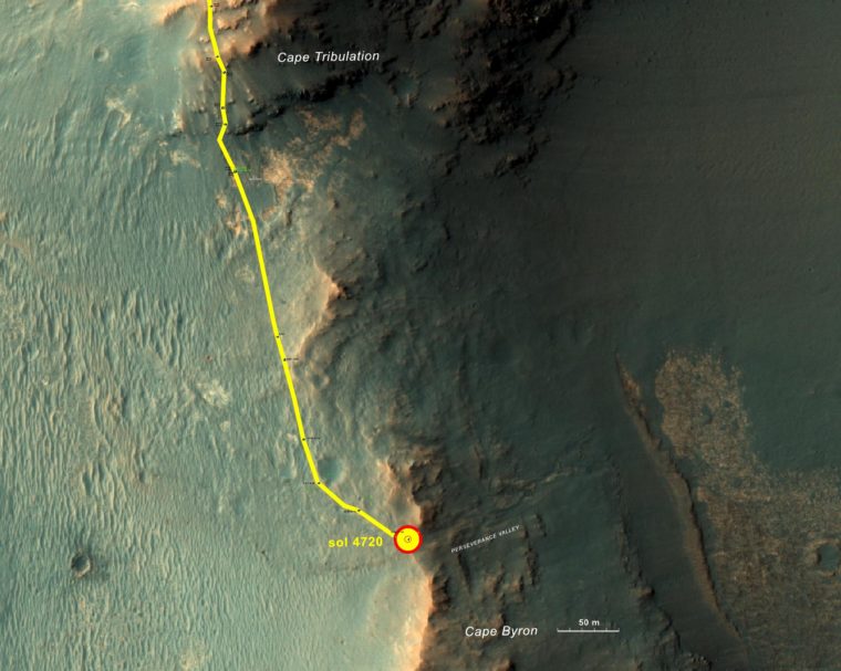
NASA’s senior Mars rover, Opportunity, is examining rocks at the edge of Endeavour Crater for signs that they may have been either transported by a flood or eroded in place by wind.
Those scenarios are among the possible explanations rover-team scientists are considering for features seen just outside the crater rim’s crest above “Perseverance Valley,” which is carved into the inner slope of the rim.
The team plans to drive Opportunity down Perseverance Valley after completing a “walkabout” survey of the area above it. The rover’s drives now use steering motors on only the rear wheels, following a temporary jam of the left-front wheel’s steering actuator this month. Opportunity has not used its right-front wheel’s steering actuator since 2005, the year after it landed on Mars.
The mission has been investigating sites on and near the western rim of Endeavour Crater since 2011. The crater is about 14 miles (22 kilometers) across.
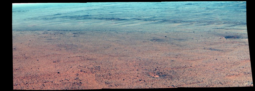
“The walkabout is designed to look at what’s just above Perseverance Valley,” said Opportunity Deputy Principal Investigator Ray Arvidson of Washington University in St. Louis. “We see a pattern of striations running east-west outside the crest of the rim.”
A portion of the crest at the top of Perseverance Valley has a broad notch. Just west of that, elongated patches of rocks line the sides of a slightly depressed, east-west swath of ground, which might have been a drainage channel billions of years ago.

“We want to determine whether these are in-place rocks or transported rocks,” said Arvidson, the James S. McDonnell Distinguished University Professor in Arts & Sciences. “One possibility is that this site was the distal end of a catchment where a lake was perched against the outside of the crater rim. A flood might have brought in the rocks, breached the rim and overflowed into the crater, carving the valley down the inner side of the rim. Another possibility is that the area was fractured by the impact that created Endeavour Crater, then rock dikes filled the fractures, and we’re seeing effects of wind erosion on those filled fractures.”
In the hypothesis of a perched lake, the notch in the crest just above Perseverance Valley may have been a spillway. Weighing against that hypothesis is an observation that the ground west of the crest slopes away, not toward the crater. The science team is considering possible explanations for how the slope might have changed.
A variation of the impact-fracture hypothesis is that water rising from underground could have favored the fractures as paths to the surface and contributed to weathering of the fracture-filling rocks.
Close examination of the rock piles along the edges of the possible channel might help researchers evaluate these and other possible histories of the site. Meanwhile the team is analyzing stereo images of Perseverance Valley, taken from the rim, to plot Opportunity’s route. The valley extends down from the crest into the crater at a slope of about 15 to 17 degrees for a distance of about two football fields.
On June 4, during the walkabout survey, the steering actuator for Opportunity’s left-front wheel stalled with the wheel turned outward more than 30 degrees. Each of the rover’s six wheels has its own drive motor, which all still work after about 27.9 miles (44.9 kilometers) of driving on Mars. Each of the four corner wheels also has an independent steering actuator — including motor and gearbox. The rover has driven about 25 miles (40 kilometers) since losing use of right-front wheel steering in April 2005.
Diagnostic testing on June 17 succeeded in straightening out the left-front wheel, a more favorable orientation than it had been in for nearly two weeks.
“For at least the immediate future, we don’t plan to use either front wheel for steering,” said Opportunity Project Manager John Callas of NASA’s Jet Propulsion Laboratory, Pasadena, California. “We can steer with two wheels, just like a car except it’s the rear wheels. We’re doing exactly what we should be doing, which is to wear out the rover doing productive work — to utilize every capability of the vehicle in the exploration of Mars.”
The team has operated Opportunity on Mars for more than 50 times longer than the originally planned mission duration of three months.
Opportunity and the next-generation Mars rover, Curiosity, plus three active NASA Mars orbiters are part of ambitious robotic exploration to understand Mars, which will continue with NASA missions to be launched in 2018 and 2020. The robotic missions help lead the way for sending humans to Mars in the 2030s. JPL, a division of Caltech in Pasadena, built Opportunity and manages the mission for NASA’s Science Mission Directorate, Washington.
For more information about Opportunity, visit: http://www.nasa.gov/rovers or http://marsrovers.jpl.nasa.gov. For additional images pertinent to this release visit: http://www.jpl.nasa.gov/news/news.php?release=2017-177
This release was issued by the Media Relations Office at the Jet Propulsion Laboratory, a federally funded research and development center managed for NASA by the California Institute of Technology.
