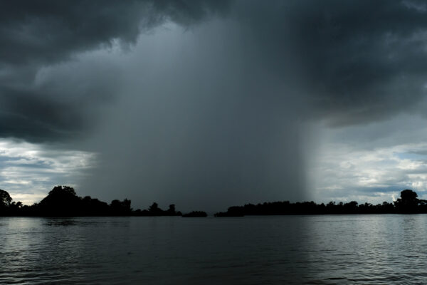
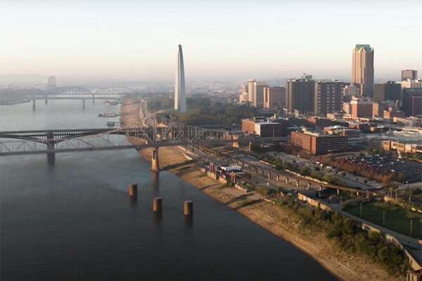
In July 2022, dramatic thunderstorms swept across the central United States, drenching the region and causing historic flash flooding. The heaviest rain fell on the greater St. Louis metropolitan area July 26 and then moved to eastern Kentucky July 28. In both areas, the storm set all-time records for total rainfall in a 24-hour period.

A rain gauge at St. Louis Lambert International Airport recorded 8.64 inches of rain July 26, much of which fell over a few hours. The historic rainfall caused two deaths and more than $1 billion in damage.
It was the nation’s costliest flood event in 2022. But was it really a 1-in-1,000-year event? An analysis from researchers at Washington University in St. Louis suggests probably not.
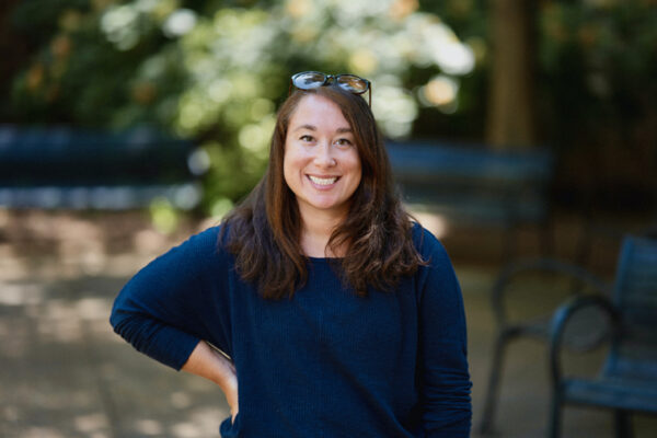
“Everybody who was in St. Louis during the storm remembers it, because their basements were flooding — or worse,” said Bronwen Konecky, an assistant professor of earth, environmental and planetary sciences in Arts & Sciences. “In the news, meteorologists were saying this was a 1,000-year flood.”
But a new study from the Konecky laboratory shows that was not likely the case and that a storm like this was closer to a 1-in-500-year event.
“In both St. Louis and eastern Kentucky, we find that the storms that happened that week and the amount of rainfall that fell were actually not as exceptional as we would have believed at the time,” Konecky said. “And storms of that magnitude are going to become more frequent moving forward.”
Putting extreme rainfall in context
Global warming is increasing the frequency of extreme precipitation events, including those events known as 1-in-1,000-year storms or floods — storms that have a 0.1% chance of occurring in any given year.
They are important in the design of infrastructure across the country. Yet frequency estimates for extreme storms are plagued by uncertainty. This fact undermines attempts to put a storm in proper context.
In terms of labeling something as a 1,000-year event, how much uncertainty are we talking about? It depends, researchers said — based on the location of the storm and other factors.
“In St. Louis, the expected range had error bars of 7 inches” of rain over a 24-hour period, said Alexander Thompson, first author of the new study, referencing the National Oceanic and Atmospheric Administration’s precipitation frequency estimates. “That means anything from daily rainfall of about 7.5 inches to 15 inches (qualified as a 1,000-year event), which is an incredibly wide range.”
That error range is in part an outcome stemming from the relative paucity of weather station observations, Thompson explained.
Rain gauge data collected by modern instruments date back only a century or so, at most. And in some geographic locations, rain gauges are few and far between. In other areas, the historical records from rain gauges can be spotty, or there might be large gaps representing years when nothing was recorded.
“With the help of statistics, you don’t need to have 1,000 years of data to call something a 1,000-year event,” Thompson said. “But one of the biggest reasons why there is such a large uncertainty range is because we’re taking that designation from only a couple of decades of observation data.”
Turning to climate models of Earth’s past
Thompson and Konecky knew there had to be a better way to look at the data.
As paleoclimatologists, they were accustomed to using other records of past climate conditions from before humans started measuring things. These records, sometimes called climate proxies, include the climate data that can be interpreted from analysis of tree rings, corals, glaciers and sediments from lakes and oceans. Scientists can use those environmental recorders to estimate past conditions, extending our understanding of climate back hundreds to millions of years. Climate proxies, in turn, help validate the performance of climate models that project both past and future climate change.
For this study, Thompson and Konecky came up with a new way to blend actual historical observations — the real rain gauge measurements from dozens of local weather stations, compiled in NOAA’s Applied Climate Information System — with the Last Millennium Ensemble, a set of simulations performed using the well-established Community Earth System Model starting at year 850 and running all the way out to 2100.
“The late 20th and early 21st century is a unique period of time when we have weather station data that overlap with climate model simulations,” Konecky said. “We used that period of overlap to figure out how to come up with a blended data set that reflects the reality of the station data, but with the long-term statistics of the climate model simulations.”
Thompson and Konecky then used this blended dataset to analyze the record-breaking rainfall event experienced in July 2022.
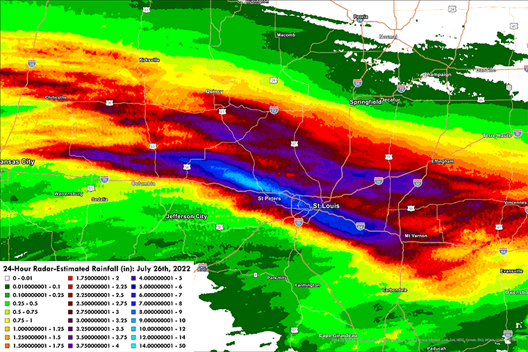
Looking at the event through their new lens, the WashU researchers found that the return period for the storm’s 24-hour rainfall was about 530 years (90% confidence interval: 370-700 years) for the greater St. Louis region and about 280 years (90% confidence interval: 115-340 years) for eastern Kentucky. This was a much shorter time period than the 1,000-year return period that was reported in the media at the time.
“Our approach provides a more precise estimate of this event’s frequency and demonstrates that a rainfall amount like that of the July 2022 event is two to four times more likely to occur in the future, relative to the preceding millennium,” said Thompson, who is now a research scientist at the University of Colorado’s Cooperative Institute for Research in Environmental Sciences and works closely with NOAA on extreme precipitation assessments.
Preparing for more big storms
In addition to catastrophic loss of life, increases in extreme precipitation take an economic toll via the rising costs of flood damage. Adaptation plans for critical infrastructure, such as storm water systems, rely on measurements of precipitation and flood frequency. These plans are projected to cost hundreds of millions of dollars annually by the end of this century.
Given the destructive capacity of extreme rainfall events, it is critical to properly assess their historical context to better understand how frequent these storms may become in the future, the researchers said.
Findings from this study can be used to better prepare society and infrastructure for the present and future risks posed by extreme precipitation. Other labs are continuing to build better models for predicting when and where extreme rainfall events might occur. “There’s an explosion of research into new and better ways to do these kinds of assessments,” Thompson said.
“Extreme storms and flooding are not going away,” Konecky said. “St. Louis needs to be ready.”
Funding: This work was supported by a David and Lucile Packard Foundation Fellowship in Science and Engineering to B. L. K. and was supported in part by NOAA Cooperative Agreement NA22OAR4320151, for the Cooperative Institute for Earth System Research and Data Science (CIESRDS).
