In August 2014, on the streets of Ferguson, Mo., protesters sought justice for Michael Brown and acknowledgement for decades of accumulated inequality. That struggle — at once political, economic, social and historical — highlighted yet another, perhaps surprising, structural barrier: the built environment of Ferguson itself.
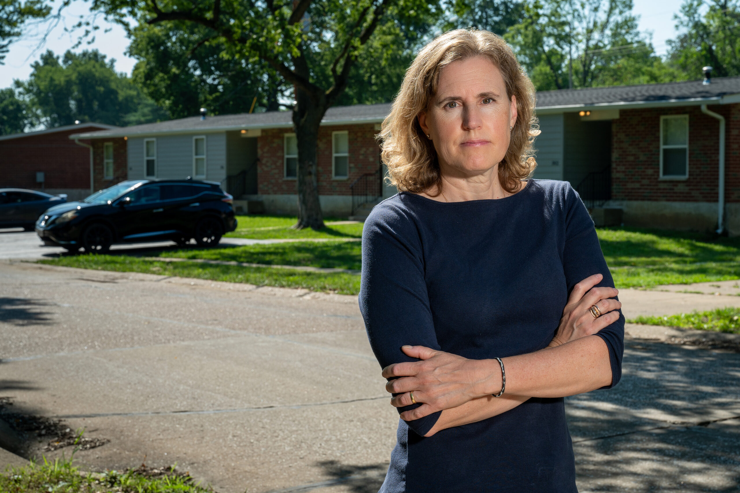
“There are lots of ways design gets weaponized,” said Patty Heyda, a professor of urban design in the Sam Fox School of Design & Visual Arts at Washington University in St. Louis. “Public space is supposed to help people have a voice. But when public policy gives way to private wealth and free-market economics, the result is fragmented, segregated and toxic.”
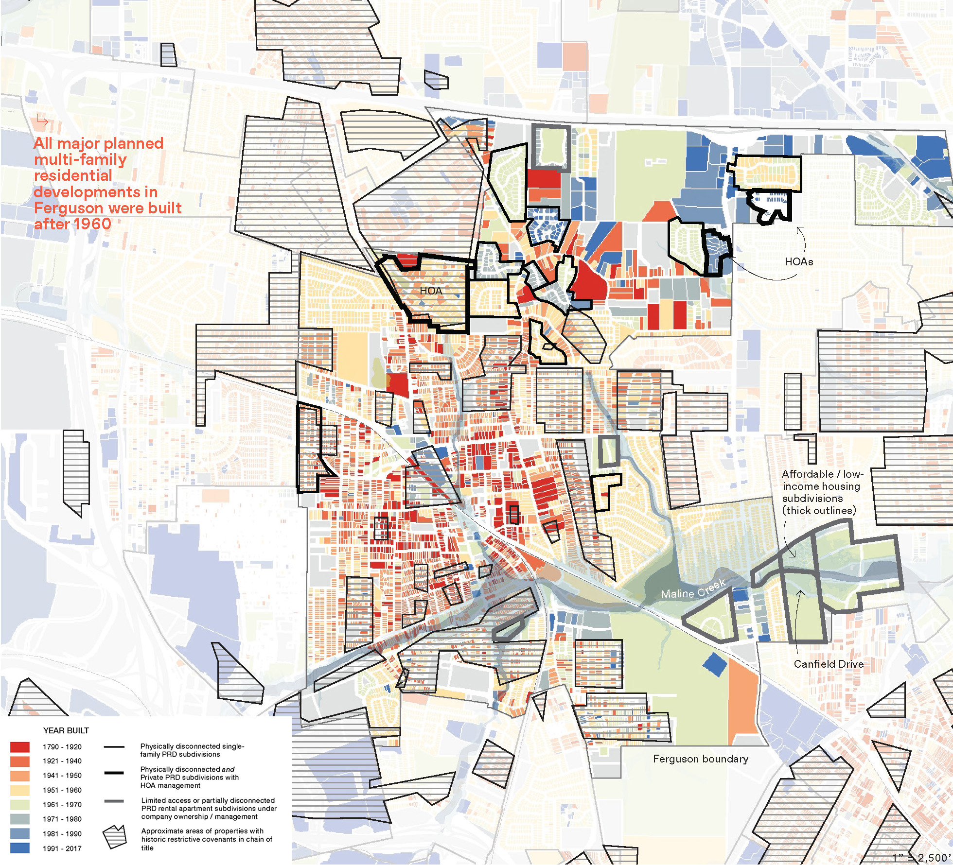
In “Radical Atlas of Ferguson, USA,” which will be released by Belt Publishing Aug. 6, Heyda utilized more than 100 maps to chart the often-opaque forces that have shaped Ferguson and other first-ring American suburbs since the early 1980s. Tax incentives, housing codes, roadways, policing, philanthropy, even landscaping — all can work against the fundamental betterment of residents’ lives.
In this Q&A, Heyda discusses Ferguson, the built environment and the roots of underlying systems.
How did this project begin?
It stems from my interest in mapping and years of teaching in St. Louis. My first studio on Ferguson was in 2016. Although pretty quickly we realized that we needed to look at all the North County areas surrounding it. These aren’t the typical suburbs. Or rather, they are typical suburbs — just not the white-picket fence stories that people think of.
The title alludes to another course, your ‘Radical Mapping’ seminar. How do you define ‘radical’?
Radical, like the word radish, comes from the Latin word for root. For me, a radical atlas may revisit data we already know — on, say, demographics, poverty or lifespan discrepancies. Or it may present new findings. But the goal of radical mapping is to help us see the underlying root systems. So in Ferguson, when we look at health, we also look at insurance availability and typologies of fast food. When we look at rates of asthma, we also look at highways, industry and deregulation.
There are reasons why conditions are so slow to change. Those reasons often reflect our political economy. Ferguson represents a perfect storm of an aging suburb amidst demographic transition and declining revenue in what is still otherwise a growth-oriented market. That incompatibility is what the book is trying to show. Many contradictions in the built environment manifest as racial exploitation.
Municipalities and developers often tout public-private partnerships. You critique them. Why?
People might imagine that the public sector builds housing, creates social amenities, fixes the streets, etc. We don’t have much of that anymore. City governments have lost funding since the late 1970s. Today, urban improvement largely goes through the private sector, which of course requires a profit. In the public-private system, it’s hard to get participation and certain standards unless an area is already booming.
Think about planned unit developments (PUDs). It’s a tool that attracts developers because they can take a large area and make their own subset of rules. For example, it should be in the public interest for neighborhoods to connect. If you attend a school a few blocks over, you should be able to make your way through without going out onto a huge, busy, dangerous road. But PUDs have no obligation to connect.
St. Louis County has 88 separate municipalities and we keep breaking things up further.
Yeah. Even within a PUD, you can get HOAs (Homeowners Associations). Those create more subdivision with additional rules. They also have separate, hyper-local tax-like dues.
The effect is to create wealthy enclaves while cordoning low-income housing into places that are hard to get to and hard to get out of. In other words, we’re reproducing segregation and diminishing the idea of a larger civic public good. But because the mechanisms aren’t all technically public, there’s little accountability.
In your research, what surprised you most?
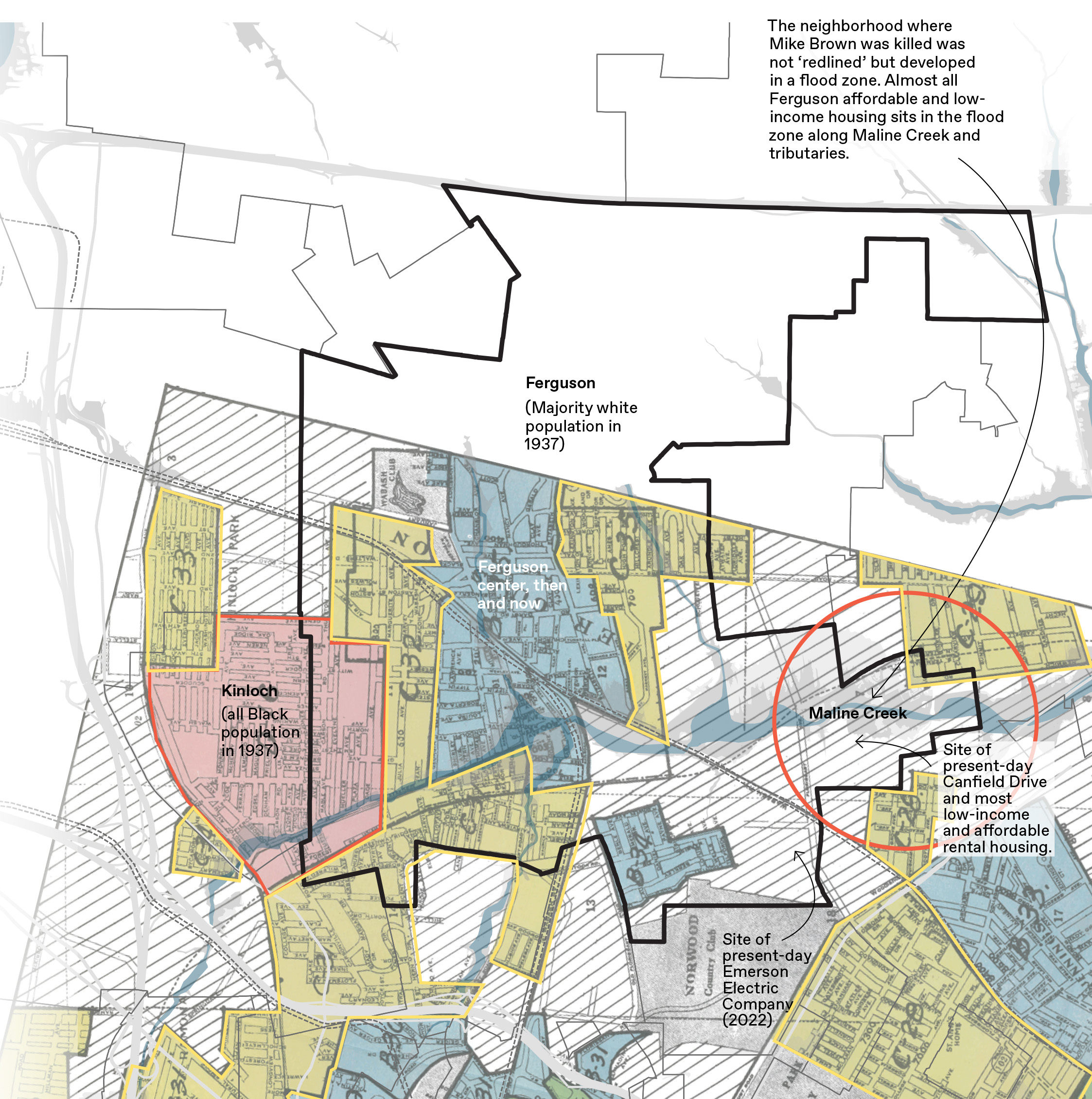
Lately there’s been a lot of media focus on redlining. This is the historic practice of denying federally backed loans to predominantly African American areas, and a clear example of U.S. public policy steering wealth accumulation in partnership with private-sector financial institutions. In St. Louis, areas formerly designed “C” for “definitely declining” or “D” for “hazardous” in the original 1937 “redline” maps are still among those areas with the lowest median income.
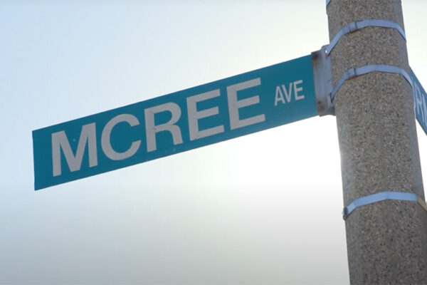
This is important context, but it doesn’t explain all the manifestations of inequality we see today. Even though Kinloch, the African American neighborhood just west of Ferguson, was entirely redlined, Ferguson, and particularly the area around Canfield Drive, where Michael Brown was killed, was not. Ferguson was predominantly white when those redlined maps were made.
What might be surprising, looking at the maps, is to realize that Canfield Drive is along a stream corridor. In the 1930s, there was some industry there, but it wasn’t considered developable land back then. Today, that area is where all the affordable housing has been built.
That doesn’t sound like a coincidence.
I call this practice floodlining. It puts the residents who live there — lower income and predominantly Black — at risk and in a more precarious housing situation.
Part of the reason has to do with lower land values in a flood-prone, formerly industrial zone. That makes private developers more willing to do an affordable project. So even though we consider the era of redlining to be over, these kinds of manipulations are ongoing. It’s just a different kind of exploitation.
Is there anything that gives you hope?
I don’t have all the answers. But I do think the protests showed us that there is incredible community capacity.
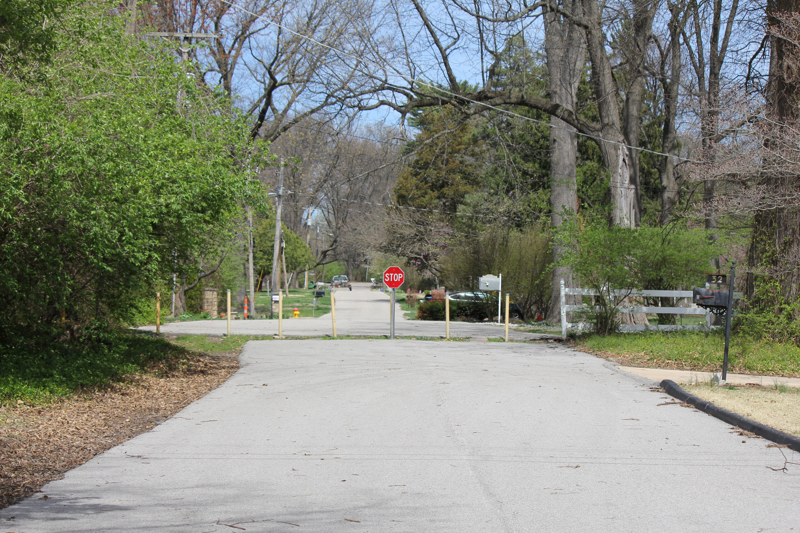
This comes back to the condition of the streets, how inhospitable they are, how fast traffic moves. In some places, you can’t even tell where the sidewalk stops and the roadway starts. Or maybe it’s also a utility corridor, or a drainage ditch, with a bus stop. When there’s a sidewalk-looking strip, cars are parked over it. Maybe it’s part of the road, maybe it’s part of the private parking lots next to it.
From a design perspective, these are all problems that reproduce issues of inaccessibility. But the street and sidewalk are public space. So during the protests, people took it back. They marched along this zone and reclaimed the blurred condition. I think there can be opportunity in the messiness of these spaces.
For designers and planners, there is also opportunity to advocate for the public through our work. We first need to visualize and acknowledge the full breadth of systems shaping the place.