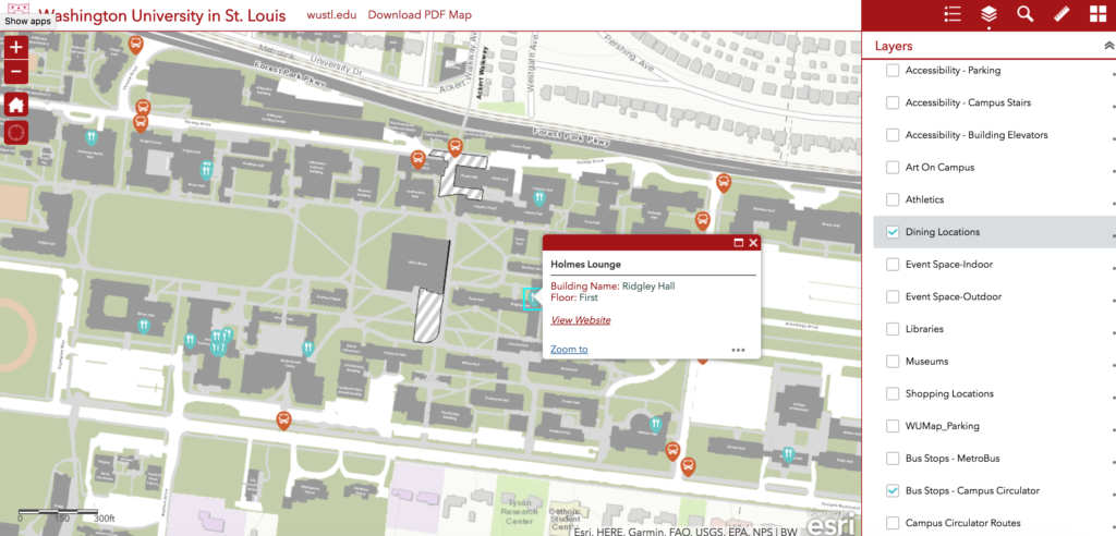
Washington University in St. Louis has launched a new campus map that will help users find accessible parking, the closest place to buy a cup of coffee and the nearest bus stop as well as a number of university buildings and points of interest. Available through the university’s website (click on the image of the Danforth Campus map and zoom in), the map will change with the campus, providing up-to-the-minute information about construction zones and parking changes.
“This map is dynamic and searchable,” said Andrew McCready, manager of zone support services with Facilities Planning & Management. “With a click, you can find the latest information you need.”
For instance, to find a campus cafe, click on the “dining locations” filter. Hover over the location of your choice for a link with hours and menus. The same goes for the Metro bus stops. A click will show all stops and link to Metro.
The map features all university campuses except for the Medical Campus and it includes on-campus and off-campus Residential Life. Ultimately, the map will provide information about interior locations.
The map will be integrated into the WUSTL Mobile app by the fall 2017 semester.
William E. Winston, GIS analyst, expects different departments and initiatives will use the base map to produce their own projects, whether that be a map of electric charging stations or a tour of campus trees.
“We are at the tip of the iceberg with this,” Winston said. “This is going to be an important and simple way to share information.”
The map was created by Facilities Planning & Management, Geographic Information Systems and the Office of Public Affairs. Map data was collected and curated by Brad Averbeck, Facilities information system manager, and built by Winston and GIS programmer Mollie Webb.