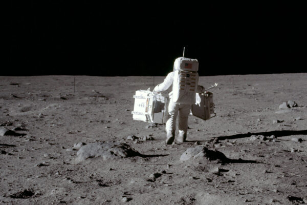
It’s a WashU story well-known: How, on July 20, 1969, a group of Washington University scientists gathered at the home of Robert M. Walker, then the McDonnell Professor of Physics, to watch Neil Armstrong step onto the Moon.
How three weeks later, Walker and a couple of colleagues traveled to Houston to collect Moon rocks and bring them back to the Danforth Campus. How the team worked night and day to study the samples to prepare a paper in time for the first Apollo 11 Lunar Science Conference five months later. How lunar research at WashU exploded from there, attracting renowned scientists and establishing the McDonnell Center for the Space Sciences in 1974.
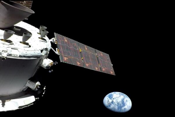
Fast forward to the present. WashU space scientists continue to play a key role in lunar research with Artemis III, the planned crewed return trip to the Moon in 2026. Among them, Arts & Sciences’ Bradley Jolliff, the Scott Rudolph Professor of Earth, Environmental, and Planetary Sciences and current director of the McDonnell Center for the Space Sciences, is part of the Artemis mission geology team; Jeff Gillis-Davis, research professor of physics, is working on a device to measure the chemistry of rocks, minerals, soil and ices on the Moon’s surface; and Paul Byrne, associate professor of Earth, environmental, and planetary sciences, is working on the geological data that will be collected by the Artemis mission and archived at the university in the NASA-supported Planetary Data System.
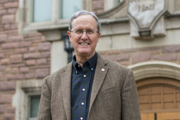
WashU has much to be proud of when it comes to space sciences, and it has so for decades. “Planetary science at WashU really began in the late 1960s when Bob Walker was hired and became the first McDonnell Professor, funded by Mr. James S. McDonnell,” Jolliff says. “That was the beginning of sort of the modern era.” Or was it?
Turns out, there’s a little-known prologue to WashU’s Moon story — one that intersects art and science, at the place where the abstract meets the concrete. The story begins in 1955 when a young woman named Patricia (Mitchell) Bridges, BFA ’55, graduated from the School of Fine Arts. Soon to be married, she was about to embark upon a career in which she would perfect a mapping technique with an airbrush that would show the Apollo astronauts every peak and valley of the Moon — and, ultimately, where to land their spacecraft.
The moon meets the eye
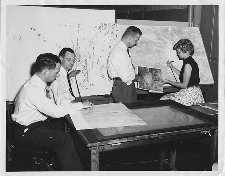
In 1959, the Aeronautical Chart and Information Center (ACIC), a precursor to today’s National Geospatial-Intelligence Agency (NGA), was tasked by the U.S. Air Force to produce detailed maps of the Moon for the newly formed National Aeronautics and Space Administration (NASA). There was a space race going on with the Soviet Union, and astronauts, engineers and scientists needed to know the position and shape of features on the Moon’s surface. Using existing photographs taken through telescopes, the three-person team, led by another WashU alum, William Cannell, BS ’59, somehow had to capture the attention — and contracts — of NASA.
The lead illustrator on the team was Bridges. Having grown up in Wood River, Illinois, she enrolled at the university in the fall of 1951, moving to nearby Clayton and attending as a commuter student. She lived close enough to walk to campus but, as she would recall in an extensive oral history interview conducted in 2015 by Kevin Schindler, historian and public information officer of the Lowell Observatory in Flagstaff, Arizona, she still needed to work to pay the rent.
“And so I made some drawings, and by golly, we got the job.’
Patricia Bridges
“I had a scholarship but needed money to buy supplies or have lunch,” she said, noting that at WashU, she studied not scientific illustration, but “just painting, art.”
In the fall of her senior year, she was hired to help restore the murals of St. Louis’ Old Courthouse, under the supervision of the National Park Service’s Walter Nitkiewicz. The project predominantly hired men because the murals are 145-feet above the rotunda. “They didn’t think any women would do that,” she recalled in the interview, “because you had to climb around on scaffolding, and you had to climb way up in the dome. I loved it.”
Such a can-do spirit would serve her well during her next job. After the mural work was completed, Bridges, now married to her hometown sweetheart, Harley Bridges, heard that the government was hiring art majors to make maps, so she applied and was hired by the ACIC.
“With an art degree you never knew what kind of job you were going to have,” she recalled. “I started doing shaded relief maps for ACIC because I was looking around for just whatever I could make a living at.” It was a good fit for an art major and a young wife living “just across the river” in Illinois.
“I started doing some special projects for the [ACIC] development office, making drawings and [experimenting ] with different ways that [it] needed to be done,” she said.
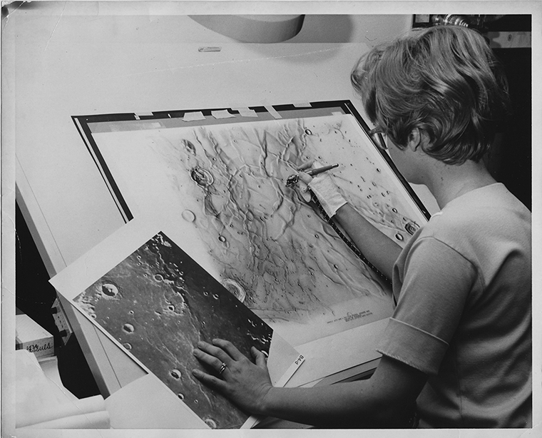
One day, she was handed photographs of the Moon and asked to add as many details as she could onto existing maps. She worked in secret, with India ink and an airbrush, in an office under the stairs at the ACIC on Arsenal Street in South St. Louis. “Other entities of the government were competing with us to get that job,” she said. “And so, I made some drawings, and by golly, we got the job.”
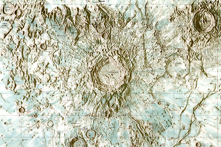
Sounds simple, yet she couldn’t have known at the time that she was about to become a hidden figure in one of the most historic mapping projects of the 20th century. With the airbrush, she painted in craters, ridges and plains, and, along the way, she created a Moon-mapping technique that would be copied and studied. The maps gave NASA detailed information it needed to determine where the astronauts of the Apollo space program would land on the Moon.
‘We all learned from Pat’
The maps were called Lunar Astronautical Charts, or LACs, and it was Cannell’s idea to draw them in sections laid out on a grid; 144 sheets in all measured 22 by 29 inches in size. Using the airbrush to fill in details, Bridges’ first map was a prototype of the Moon’s most visible feature, the Copernicus Crater. But it was clear they were going to need better information to create the maps in the amount of detail that NASA needed. So Cannell was sent all over the country to scour locations for a telescopic home and found one sitting 7,200 feet above sea level at the historic Lowell Observatory — the 24-inch Clark refractor telescope.
Built in 1896, it was the telescope famously used by Percival Lowell to study Mars (and the telescope Vesto Slipher used to first observe the expanding nature of the universe). But by 1961, the telescope was available for other uses, because as Flagstaff grew so did the amount of light pollution at night, said Schindler. That made it harder to look further out into our solar system, “but the Moon is so bright the amount of light didn’t matter,” Schindler says.
“The technique did take awhile to master and learn to do the proper shading. We all learned from Pat.”
Gail Gibbons, a member of the team tasked with mapping the Moon.
In September 1961, Cannell, Bridges and the third team member, ACIC cartographer James Greenacre, moved to Flagstaff after contracting with the observatory for use of the telescope and office space.
Each person had a role.
Photographs provided the foundation for the team’s lunar charts, but they also filmed movies of the Moon. Each recording contained hundreds and hundreds of still images, which allowed the team to choose photos least distorted by air turbulence. The best photos were sent back to St. Louis, where the photos were “rectified,” or altered to make allowances for the curvature of the Moon’s surface and other distorting factors, and then sent back to Flagstaff.
But photographs weren’t enough to capture the level of detail. The map-making team also spent nights at the Clark telescope observing the Moon’s surface, because the human eye could see more through the telescope than on photos — “about four times as much,” Cannell told a reporter for the Arizona Daily Sun. The ACIC team ended up discovering thousands of small craters on what previously had been thought of as a smooth surface — important details for selecting a landing site.
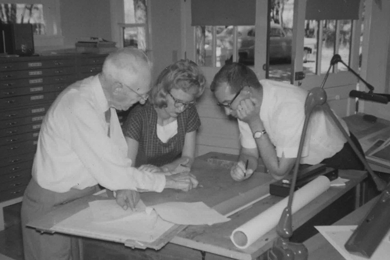
Cannell and Greenacre would sit at the Clark telescope with photos of the lunar surface, filling in details photographs missed. Their notes then went to Bridges, who also made observations herself to confirm or clarify her team’s notes. Sessions at the telescope could last several hours at a time, depending on how much of the area that the team was charting was illuminated. “If it was illuminated, we were there,” Bridges recalled in the oral history interview.
By 1965, the team had grown to 12 observers and scientific illustrators, including Gail Gibbons, who joined the effort as a 20-year-old graduate of the University of Arizona. Now living in Arizona, she remembers Bridges taking a young illustrator under her wing, teaching her what had become known as the “Bridges technique,” working on large wooden drafting tables set at a slant.
Over a Zoom interview, she recalled drawing the maps with detail. “On top of a large light box sitting on top of the drafting table, we placed the mosaic photo, which was the size of the end map,” Gibbons says. “Over that, we placed a thick translucent piece of plastic, and that’s what we drew on. The mosaic gave us the placement and dimensions and the rough outlines of the craters and mountains.
“We worked in shades of gray with the airbrush — which proved to be a temperamental creature,” she says. “The technique did take a while to master and learn to do the proper shading. We all learned it from Pat.”
The trailblazer
ACIC’s work on the lunar maps continued in Flagstaff until 1969, when Cannell and the team returned to St. Louis. By that time, Bridges had left the project to stay home with her two daughters, but not before training the eight illustrators who carried on the airbrushing technique.
“Pat was a trailblazer, and her role in the Apollo program cannot be underestimated,” Gibbons says. “Her artistry was the best of all of us. She was my mentor and had the airbrush techniques down to a T. I never came close to her work.”
The maps stand up even today, when simply Googling “Lunar QuickMap” can get anyone to the Lunar Reconnaissance Orbiter Camera (LROC) website. There, a user can zoom in and view the surface of the Moon as close as 50 meters away, noticing every rock, blemish, hill and shadow on the surface.
But before there was the LROC (and the internet), there was Pat Bridges.
“What really impresses me is that you could take those early maps and superimpose digital data from orbit around the Moon, and it lines up. They made them that accurate. You can then understand where the chemistry correlated with morphologic features on the surface, because you could see craters and hills and volcanoes. And you simply say, ‘Wow.’ This wasn’t just artistic; it was highly technical.”
—Jeff Gillis-Davis
And these early maps helped show the way for the first men on the Moon. By the time Armstrong took his first steps, Bridges had 6- and 4-year-old daughters and was pregnant with her third child, a boy. Even though she was no longer on the team, she watched the historic moment with her family and former colleagues — along with millions of others worldwide. Bridges told Schindler that watching those first steps made it “something real.”
Cannell also remembered feeling tense before the landing. “We knew the precise spot where they were supposed to land, but we didn’t know if they would actually hit it,” he told the South Bend Tribune in 2004. “We worried, of course, that they might crash or end up in the wrong place.”
Cannell and his team would return to St. Louis that fall and continue to evolve their mapping work. Bridges would return to work a year later with the U.S. Geological Survey (USGS) in Flagstaff, doing the same type of airbrush-mapping work drawing maps of Mars.
The family had put down roots in Flagstaff, with her husband teaching junior high social studies and Bridges working outside the home in an era when that was not the norm. But not once in her extended interview with Schindler in 2015 did she talk about the challenges that may have held.
Laura Ball, her middle child who still lives in Flagstaff, has nothing but fond memories of her childhood. “By the time I was old enough to know what she was doing, she was at the USGS,” Ball says. “She was low-key and never described herself as doing anything special. As a kid, I didn’t think having a working mom was that unusual, even though a lot of my friends had moms who didn’t work. Now, I feel nothing but pride for what she was able to pull off.”
Pull it off she did. Her maps endure online, in archives and in history books. “The fact that she wasn’t involved with geoscience or geography and produced such detailed maps is remarkable,” Jolliff says. “I wish I could have met her.”
“Going to the Moon was humankind’s greatest achievement, in so many ways. But it took 400,000 people to do it — people just like you and me. Pat was one of those, but she never once broadcast that feat or said ‘I’m a mapper. I’m helping us get to the moon!’ ”
Kevin Schindler, Lowell Observatory
Schindler got to meet Bridges many times, working with her on oral history projects or anniversary events. “She was always so welcoming and gracious,” he says. Bridges shared with the observatory’s archives a scrapbook she kept of clippings and photographs from those early days in Flagstaff. In it are photographs of the early Moon-mapping days at the observatory and various newspaper clippings about the program, including one from 1963 that details a visit from the Apollo astronauts, including Armstrong and James Lovell. The astronauts had come to the observatory to learn about the mapping program and watch Bridges in action.
Bridges and her husband would remain in Flagstaff the rest of their lives, passing away within four months of each other in 2021. Near the end of her life, she battled Alzheimer’s disease, her daughter says, but she made the best of it. “To us,” Ball says, “she was always just our mom.” Ball says her mom left her family numerous paintings and artworks, including a self-portrait of herself as a young woman.
And she left to all of us a legacy of helping send the Apollo astronauts to the Moon. “Going to the Moon was humankind’s greatest achievement, in so many ways,” Schindler says. “But it took 400,000 people to do it — people just like you and me. Pat was one of those, but she never once broadcast that feat or said, ‘I’m a mapper. I’m helping us get to the Moon!’”
Portions of this story, written by Jessica Daues, first appeared on the NGA News website in “The Art of Lunar Mapping: ACIC’s Patricia Bridges Airbrushed Americans’ Path to the Moon” published in June 2024. Daues is a former WashU staff member in University Marketing and Communications.
